
Duluth – Superior Area Could Face Flash Freeze Wednesday Night Into Thursday
We knew the forecast this week predicted a storm Wednesday night into Thursday that could bring a variety of conditions to the Northland. Thunderstorms, rain, ice, snow and strong winds were all possible throughout the area.
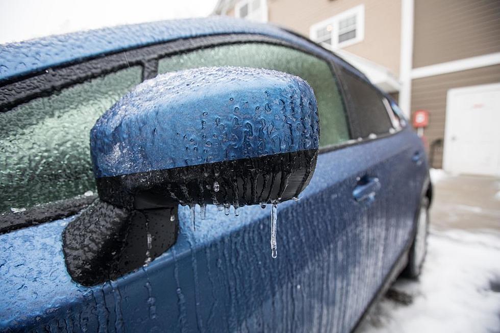
As Wednesday night approached, the chance for severe weather remained and both the National Weather Service and the Minnesota Department of Transportation issued warnings, which included a warning to be on the lookout for a "flash freeze".
What's the heck is a flash freeze? It's what happens when temperatures drop and rain begins to change over to snow. According to the US National Weather Service Duluth Minnesota Facebook post Wednesday afternoon:
A flash freeze happens when roads are wet and then temperatures quickly drop below freezing, creating black ice on roadways, sidewalks, and any other surfaces. This will likely lead to a tricky Thursday morning commute. In addition, rain will change over to snow Thursday morning as the temperatures tumble, combined with strong westerly winds.

If this occurs while you're out on the road it's a scary situation as you may think the roads are still just wet, until you attempt to stop. With that in mind, they went on to advise motorists that if travelling is necessary that speeds should be reduced and distance between vehicles should be increased.
The Minnesota Department of Transportation also used their Facebook page to warn people of the potentially dangerous conditions this unusual and messy December storm could cause.
The reminded all motorists that the ability to monitor road conditions is always available through 511mn.org. That site features an interactive map to help give you road conditions throughout the state. There is also a Minnesota 511 app available.
Time will ultimately tell where this storm tracks and where the worst conditions will exist, but it's always best to play it safe until that time and only travel if absolutely necessary.
LOOK: The most expensive weather and climate disasters in recent decades
Gallery Credit: KATELYN LEBOFF
TIPS: Here's how you can prepare for power outages
More From B105


