Winter Storm Warnings Now In Over 24 Minnesota, Wisconsin Counties
Winter may not arrive on the calendar until December 21, but severe winter weather is coming before that for many portions of Minnesota, Wisconsin, and North Dakota, and it could create very dangerous travel conditions.
On Wednesday, the National Weather Service issued a series of 7 Winter Storm Warnings, the majority of which are in effect at midnight on Thursday and then continue all day Thursday before ending at midnight.
Below are warnings that were issued, including what people in the areas of impact are advised to do once the storm hits their area.
Winter Storm Warning #1
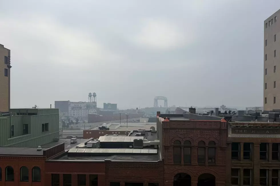
This warning includes the cities of Duluth, Two Harbors, and Silver Bay. Earlier, the National Weather Service thought portions of this area could get over 8 inches of snow, but they have lowered that slightly with this warning.
- WHAT: Heavy snow expected. Total snow accumulations between 4 and
6 inches, with locally higher amounts along the elevated terrain of the North Shore. - WHERE: Carlton, South St. Louis, and Southern Lake Counties. This includes the Tribal Lands of the Fond du Lac Band.
- WHEN: Continuing all day Thursday until midnight.
- IMPACTS: Travel could be very difficult. The hazardous conditions will impact the Thursday morning commute and could impact the Thursday evening commute.
- PREPAREDNESS ACTIONS: If you must travel, keep an extra flashlight, food, and water in your vehicle in case of an emergency. Call 5 1 1 or visit 511mn.org for Minnesota road information.
Winter Storm Warning #2
This warning includes the cities of Pine River, Pine City, Brainerd, Hinckley, and Aitkin.
- WHAT: Heavy snow expected. Total snow accumulations between 4 and 6 inches.
- WHERE: Crow Wing, Pine, South Aitkin, and South Cass Counties. This includes the Tribal Lands of the Mille Lacs Band, Hinckley, Lena Lake and, East Lake areas.
- WHEN: Beginning midnight Thursday and continuing all day Thursday until midnight.
- IMPACTS: Travel could be very difficult. The hazardous conditions could impact the Thursday morning and evening commutes.
- PREPAREDNESS ACTIONS: If you must travel, keep an extra flashlight, food, and water in your vehicle in case of an emergency. Call 5 1 1 or visit 511mn.org for Minnesota road information.

Winter Storm Warning #3
This warning includes the cities of Alexandria, Little Falls, Princeton, Long Prairie, Chaska, St Cloud, Shakopee, Cambridge, Chanhassen, Hastings, Blaine, Monticello, Stillwater, St Paul, Mora, Minneapolis, Victoria, Elk River, Center City, and Sauk Rapids.
- WHAT: Heavy snow is expected. Total snow accumulations between 5 and
7 inches - WHERE: Portions of central, east central, and west central Minnesota.
- WHEN: Beginning midnight Thursday and continuing all day Thursday until midnight.
- IMPACTS: Travel could be very difficult. The hazardous conditions could impact the Thursday morning and evening commutes.
- PREPAREDNESS ACTIONS: If you must travel, keep an extra flashlight, food, and water in your vehicle in case of an emergency. Call 5 1 1 or visit 511mn.org
for road conditions.
Winter Storm Warning #4
This warning includes the cities of Willmar, Hutchinson, Glenwood, Litchfield, and Morris
- WHAT: Heavy snow expected. Total snow accumulations between 5 and
7 inches. - WHERE: Kandiyohi, McLeod, Meeker, Pope, and Stevens Counties.
- WHEN: Beginning midnight Thursday and continuing all day Thursday until midnight.
- IMPACTS: Travel could be very difficult. The hazardous conditions could impact the Thursday morning and evening commutes.
- PREPAREDNESS ACTIONS: If you must travel, keep an extra flashlight, food, and water in your vehicle in case of an emergency. Call 5 1 1 or visit 511mn.org for road conditions.
Winter Storm Warning #5
This warning includes the Wisconsin cities of Rice Lake, Hudson, Menomonie, Ladysmith, River Falls, Chippewa Falls, Eau Claire, Osceola, and Durand.
- WHAT: Heavy snow expected. Total snow accumulations between 5 and 7 inches.
- WHERE: Barron, Polk, Rusk, Chippewa, Dunn, Eau Claire, Pepin, Pierce, and St. Croix Counties.
- WHEN: From 3 AM Thursday to 3 AM Friday.
- IMPACTS: Travel could be very difficult. The hazardous conditions could impact the Thursday morning and evening commutes.
- PREPAREDNESS ACTIONS: If you must travel, keep an extra flashlight, food, and water in your vehicle in case of an emergency. Call 5 1 1 or visit 511wi.gov
for road conditions.
SEE NOW: 3 Minnesota Hospitals Get Startling ‘D’ Grade For Patient Safety
Winter Storm Warning #6
This warning includes the cities of Washburn and Bayfield in Wisconsin.
- WHAT: Heavy snow expected. Total snow accumulations between 5 and 8 inches.
- WHERE: Bayfield County. This includes the Tribal Lands of the Red Cliff Band. Recreation spots such as the Apostle Islands National Lakeshore.
- WHEN: From 3 AM Thursday to 6 AM Friday.
- IMPACTS: Travel could be very difficult. The hazardous conditions will impact the Thursday morning and evening commutes.
- PREPAREDNESS ACTIONS: If you must travel, keep an extra flashlight, food, and water in your vehicle in case of an emergency. Call 5 1 1 or visit
www.511wi.gov for Wisconsin road information.
Winter Storm Warning #7
This warning, which includes southeast North Dakota, ends before all the other warnings that were issued and includes the cities of Elbow Lake, Perham, Ashby, Lisbon, New York Mills, Valley City, Wahpeton, Breckenridge, Lawndale, Herman, Fergus Falls, Staples Airport, Enderlin, Battle Lake, Detroit Lakes, Menahga, Parkers Prairie, Fargo, McLeod, Hoffman, Henning, Erdahl, Moorhead, Wadena, Barrett, and Shoreham.
WHAT: Heavy snow expected. Total snow accumulations between 3 and 7 inches. Winds gusting as high as 40 mph.
WHERE: Portions of central, northwest, and west central Minnesota and southeast North Dakota.
WHEN: This warning went into effect at 9 PM Wednesday and continues until 6 PM Thursday.
IMPACTS: Roads, and especially bridges and overpasses, will likely become slick and hazardous. Whiteout conditions are expected and will make travel treacherous and potentially life-threatening. Plan on slippery road conditions. The hazardous
conditions could impact the Thursday morning and evening commutes.
PREPAREDNESS ACTIONS: Persons should consider delaying all travel. If travel is absolutely necessary, drive with extreme caution. Consider taking a winter storm kit along with you, including such items as tire chains, booster cables, flashlights, shovels, blankets, and extra clothing. Also take water, a first aid kit, and anything else that would help you survive in case you become stranded.
SEE NOW: Wisconsin Residents Now Warned Not To Travel To These Locations
16 Things You Should & Shouldn't Do During Winter In Minnesota + Wisconsin
Gallery Credit: Lauren Wells
LOOK: The most extreme temperatures in the history of every state
Gallery Credit: Anuradha Varanasi
More From B105