

Minnesota North Shore’s Waterfalls Drying Up Under Drought Conditions [VIDEO]
You’ve likely seen the viral photo of a dry lower falls at Gooseberry Falls State Park getting shared on social media. Many people saw the photo and asked “is this real?” or “is this from this year?”
It has been an exceptionally dry year, with the Northland needing nearly a foot of rain to end the drought that is spurring on worries about wildfires across much of Minnesota.
Having seen the photo of Gooseberry Falls, I had to explore for myself to see just how bad things are at a few popular waterfalls and river locations around the Northland. So I set out to see what I could see, capturing some video (below) and photos at a handful of locations.
Jay Cooke State Park
The first spot I stopped was nearby Jay Cooke State Park, where the St. Louis River flows through a rocky riverbed that creates rapids and some small waterfalls near the swinging bridge just steps away from the park’s visitor center.

While water levels are definitely low, there is still moving water. The St. Louis River, unlike some of the other rivers along the North Shore, does get some tributary help including the nearby Cloquet River and Whiteface River upstream that provide more water to the flow of things.

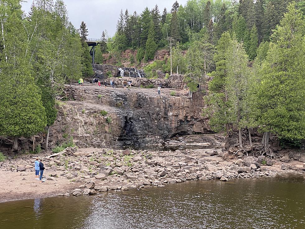
Illgen Falls - Baptism River
Next, I headed up the shore to Tettegouche State Park, which has a few waterfalls along the Baptism River. Not having the time to hike into the Two-Step Falls of High Falls, I checked out the easy-to-access Illgen Falls, just off Highway 1 to see what the river looked like.
The river and the falls was certainly quite low, but there is still some water moving along the riverbed and the falls are still active. The majority of the riverbed is bare rock, which can be better-seen in the video below. If anyone happens to know the status of the lower falls along the Baptism River before I can hike out to them, feel free to let me know!

Beaver Falls - Beaver River
Right off the roadway in Beaver Bay is a nice little park with access to Beaver Falls, which cascades down a pair of falls on one side of Highway 61 before reaching Lake Superior on the other side of the road.
These aren’t a particularly deep falls even at higher water levels, but they offer a decent amount of rolling water most of the year. These falls are almost completely dry, with only a couple of small trickles through cracks in the rocks. You can see a lot better what the conditions look like in the video below.

Gooseberry Falls State Park
The Gooseberry River, which creates the various waterfalls that draw thousands of people each year, has slowed to a dribble of itself this summer. While I didn’t head up to the Fifth Falls, the further you head down the river toward the lake, the less waterfall activity there is.
The Upper Falls, which are the ones just under the Highway 61 Bridge, are a mere fraction of their normal water flow, but they are the most active of the three most visited falls in the park. The Middle Falls, which is where the main path from the visitor center leads, are down to a tiny portion of their often mighty levels.
Then there’s the lower falls, which is where the viral photo circulating online was taken.
The Lower Falls forks into a steeper falls on the western side and falls down a more gradual, cascading falls on the eastern side. The western side of the falls far more dramatic, literally a tiny dribble that you can’t see unless you are up close. The eastern cascading falls is currently a small stream made up of the low amount of water making its way down the falls further upstream.
You can get a better view of the entire falls area in the video below.
10 Places a Duluthian Would Be Ashamed to Admit They've Never Been
Pick Up Lines Only Twin Ports Residents Will Appreciate
More From B105


