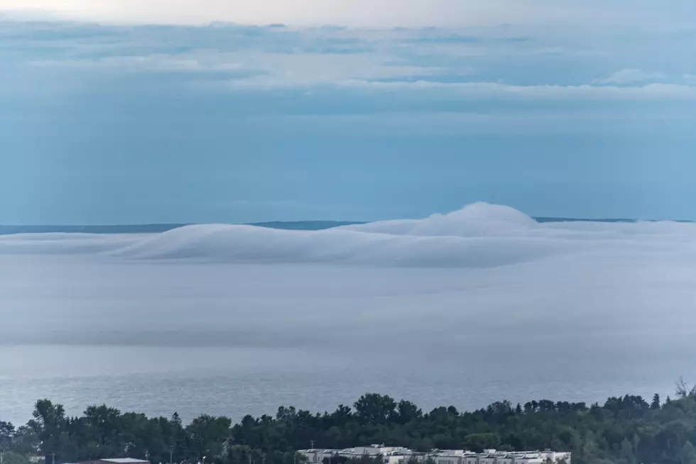
Check Out These Cool Photos Of ‘Waves’ Of Fog On Lake Superior Thursday Night
Following a humid and stormy afternoon on Thursday, air temperatures cooled down and we got an interesting sight over Lake Superior as some fog developed. This low-lying fog created some cool visuals as it rolled along the surface of Lake Superior and onto land.
"Waves" of fog were visible across the surface, created by the right combination of a light wind, differences in temperature, and levels of moisture in the air. As you can see in the photos, this fog was nudged toward the Wisconsin shoreline through the evening by light winds, and areas of Superior surrounding areas saw some fog as well. Later in the evening, fog also found its way toward Duluth.
Check out the photos of Thursday night’s fog below. Just tap on any photo to enlarge it. Did you get any photos of the fog? You can always submit photos of your own to us via our mobile app, using the submit media button in the app's menu (or just tap here if you're viewing this in our app).
Fog Waves On Lake Superior
More From B105