
UPDATE: Winter Storm Warning, Up to 18 Inches Of Snow Impacting 20 Cities In Wisconsin + Minnesota
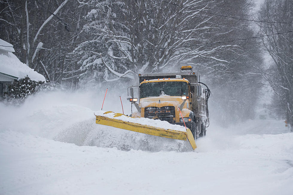
Wasn't it just last week we kissed winter weather goodbye and enjoyed unseasonably warm temperatures? While that is true, anyone living in Wisconsin or Minnesota knows to enjoy the spring moments when they can because things can change quickly.
Unfortunately, that seems to be the case this weekend as the National Weather Service is tracking a complex storm system expected to impact the region Sunday into Monday.
They began updating several Winter Storm Watches Saturday, with 24 cities across Wisconsin and Minnesota expected to get up to 9 inches of snow along with some ice.
On Sunday, many Winter Storm Watches were upgraded to Winter Storm Warnings, with one area possibly receiving 18 inches of snow. Let's break down the Wisconsin and Minnesota areas where the most snow is expected and warnings were issued.
The first Winter Storm Warning covers a total of three Wisconsin cities: Spooner, Hayward, and Phillips. It begins Sunday afternoon and runs through Monday morning:
- WHAT: Heavy mixed precipitation expected. Total snow accumulations of 3 to 9 inches and ice accumulations of a light glaze. Winds gusting as high as 40 mph causing blowing and drifting snow.
- WHERE: Washburn, Sawyer, and Price Counties. This includes the Tribal Lands of the Lac Courte Oreilles Reservation.
- WHEN: From 1 PM this afternoon to 7 PM CDT Monday.
- IMPACTS: Travel could be very difficult. Patchy-blowing snow could significantly reduce visibility. The hazardous conditions could impact the morning or evening commute.
- ADDITIONAL DETAILS: This should be wet and heavy snow.

Another Winter Storm Warning was added to include 4 additional cities in Minnesota: Isabella, Two Harbors, Silver Bay, and Grand Marais
- WHAT: Heavy mixed precipitation expected. Total snow accumulations of 5 to 10 inches and ice accumulations of around one-tenth of an inch. Winds gusting as high as 50 mph causing blowing and drifting snow.
- WHERE: Northern Cook and Lake, Southern Lake, and Southern Cook Counties. This includes the Tribal Lands of the Grand Portage Reservation.
- WHEN: From 8 AM Sunday to 7 PM CDT Monday
- IMPACTS: Travel could be very difficult. Patchy, blowing snow could significantly reduce visibility. The hazardous conditions could impact the morning or evening commute. Gusty winds could bring down tree branches.
- ADDITIONAL DETAILS: This should be wet and heavy snow. Power outages are possible.
Are we having fun yet? A third Winter Storm Warning issued impacts the Wisconsin cities Ladysmith, Chippewa Falls, and Eau Claire
- WHAT: Heavy snow expected. Total snow accumulations of 4 to 10 inches. Winds gusting as high as 45 mph.
- WHERE: Rusk, Chippewa, and Eau Claire Counties.
- WHEN: 7 PM Sunday to 10 AM CDT Monday.
- IMPACTS: Travel could be very difficult. Patchy, blowing snow could significantly reduce visibility. The hazardous conditions could impact the morning commute.
Another Winter Storm Warning in Wisconsin is predicting up to 9 inches of snow, plus an ice glace, for the cities of Merrill, Tomahawk, Eagle River, Lac Du Flambeau, and Rhinelander:
- WHAT: Rain changing to sleet, freezing rain then all snow. Total snow and sleet accumulations between 4 and 9 inches and ice accumulations around a light glaze. Locally higher snow amounts in western Vilas and Oneida counties. Winds gusting as high as 45 mph.
- WHERE: Lincoln, Oneida, and Vilas Counties.
- WHEN: From 4 PM Sunday to 7 PM CDT Monday.
- IMPACTS: Travel could be very difficult. The hazardous conditions could impact the Monday morning and afternoon commutes. Gusty winds could bring down tree branches and create low visibility.
Where are the areas expected to receive the highest snowfall totals? That would be near the Twin Ports area, including the Wisconsin cities of Superior, Washburn, Bayfield, Ashland, and Hurley. This Winter Storm Warning involves up to 18 inches of snowfall and an icy glaze, with the highest totals expected in northern Iron County:
- WHAT: Heavy mixed precipitation expected. Total snow accumulations of 6 to 14 inches, except 14 to 18 inches for northern Iron County and ice accumulations of a light glaze. Winds gusting as high as 40 mph causing blowing and drifting snow.
- WHERE: Douglas, Bayfield, Ashland and Iron Counties. This
includes the Tribal Lands of the Red Cliff Band, the northwestern area of the Lac du Flambeau Band and the Bad River Reservation. - WHEN: Until 7 PM CDT Monday
- IMPACTS: Travel could be very difficult to impossible. Patchy, blowing snow could significantly reduce visibility. The hazardous conditions could impact the morning or evening commute.
- ADDITIONAL DETAILS: This should be wet and heavy snow.
Updates on weather warnings can be tracked online with the National Weather Service.
LOOK: The most expensive weather and climate disasters in recent decades
Gallery Credit: KATELYN LEBOFF
LOOK: Here are the states where you are most likely to hit an animal
Gallery Credit: Dom DiFurio & Jacob Osborn
TIPS: Here's how you can prepare for power outages
More From B105


